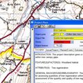
Using HBSMR to record Local Wildlife Site data

Client: Cheshire West and Chester Council

CW&C LWS data in HBSMRCheshire West and Chester Council completed the task of creating a new register of locally designated wildlife sites. The new list was to be stored and managed in HBSMR, which had been in use by the Cheshire Historic Environment Record since 2002. exeGesIS was contracted to develop and install the necessary customisations.

... read more
 

CMSi API

Client: Natuurmonumenten

Development of CMSi APIThe CMSi API is a set of web services that allows CMSi data to be exported and imported into other systems via a standard HTTP requests. The API is available for all plugin modules to CMSi (for example the Property and Agreements module, Observations and Vegetation module) and is part of the core CMSi system.

... read more
 

Volumetric analysis using a mini-plane DSM

Client: Natural Resources Wales

Volumetric analysis using a mini-plane DSMExegesis undertook an aerial survey of a site and orthorectified and mosaicked the imagery to create a single image. We also generate a digital surface model, which was compared against lidar data to give the change in height. We then determined the volume of additional material within patches identified from the aerial photography.

... read more
 

CMSi Property & Agreements Module

Client: GBNL (a consortium of Dutch conservation organisations) and CMSC

Development of CMSi Property & Agreements ModuleexeGesIS created a set of modules that allowed ownership data, all property transactions, agreements, rights and assets to be integrated with site and management plan data held in CMSi. This transforms CMSi into a complete site management system rather than just about conservation planning and recording.

... read more
 

Definition and mapping of open mosaic habitats on previously developed land: phase 2 testing methods and developing the habitat inventory

Client: Defra

The hoverfly Xylota sylvarumWe identified the key features and enhanced knowledge of the distribution of UK BAP Open Mosaic Habitats on Previously Developed Land. This involved the development of a survey methodology and a survey of 98 sites to identify OMH habitat, including a survey of invertebrates on 50 - the largest single survey of its kind in the UK.

... read more
 

Extending professional access to the Lincolnshire Historic Environment Record

Client: Lincolnshire County Council

Lincolnshire District CouncilsexeGesIS developed a website to extend professional access to the Lincolnshire Historic Environment Record to district-council-based conservation officers. The website has been widely welcomed as the default source of historic environment data for professional use in the seven district councils of the county.

... read more
 

Norfolk Heritage Explorer

Client: Norfolk Historic Environment Service

Norfolk Heritage ExplorerWorking closely together with Norfolk Landscape Archaeology we developed the Norfolk Heritage Explorer, a sophisticated website making Norfolk's rich Historic Environment Record data accessible to the public. The website has recently been given a facelift, becoming the first of our heritage websites to use the mojoPortal CMS.

... read more
 
Find out more