Wales bait digging survey Client: Natural Resources Wales Exegesis were contracted to establish whether aerial imagery from UAVs could be used to investigate the spatial and temporal extent of bait digging at selected sites in Wales. ... read more May 2020. Categories: 3D analysis Biodiversity Data analysis Ecology GIS Habitat map Habitat survey Marine data mini-plane Spatial data capture
Morfa Friog Coastal Realignment Project saltmarsh vegetation monitoring Client: Natural Resources Wales Exegesis was contracted to establish vegetation monitoring at a saltmarsh coastal realignment site. This required the collection of high resolution aerial imagery, quadrat based vegetation survey, mapping in GIS and production of a detailed report. ... read more January 2019. Categories: 3D analysis Biodiversity Data analysis Ecology GIS Habitat map Habitat survey mini-plane Spatial data capture
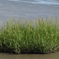
Common cord-grass Spartina anglica and its management in estuarine Natura 2000 sites Client: Natural England Exegesis were contracted to undertake a review of Spartina anglica in England’s Natura 2000 Sites. This covered its impacts on designated features, effects on accretion and erosion, distribution and extent, and a review of control techniques. A protocol was developed to monitor S. anglica and help identify any negative impact. ... read more October 2014. Categories: Data analysis Desk research Ecology GIS Habitat map Habitat survey Invasive species Literature review Marine data Survey methodology development
Definition and mapping of open mosaic habitats on previously developed land: phase 2 testing methods and developing the habitat inventory Client: Defra We identified the key features and enhanced knowledge of the distribution of UK BAP Open Mosaic Habitats on Previously Developed Land. This involved the development of a survey methodology and a survey of 98 sites to identify OMH habitat, including a survey of invertebrates on 50 - the largest single survey of its kind in the UK. ... read more April 2013. Categories: Biodiversity Brownfield Consultation Data analysis Database Desk research Ecology Habitat inventory Habitat survey Invertebrate survey Spatial data capture Statistical analysis Survey methodology development Web map Web site
Supply of Green Infrastructure monitoring Client: Natural England exeGesIS developed a methodology for monitoring Green Infrastructure (GI) delivery based upon Natural England's existing Integrated Site Assessment methodology. This encompassed ecology, access, green roofs and other aspects of GI delivery. ... read more March 2013. Categories: Biodiversity Consultation Countryside access Ecology Green Infrastructure Habitat survey Survey methodology development Workshop
Species Observations and Vegetation Recording Module Client: GBNL (a consortium of Dutch conservation organisations) The observations and vegetation mapping module for CMSi was developed to allow managers to integrate wildlife records and vegetation surveys with their site data. This covers site monitoring projects, incidental records, data browsing and filtering, and includes a sophisticated report wizard. ... read more March 2013. Categories: Biodiversity CMSi Conservation Management Planning Database Desktop application Ecology Habitat survey In-field technology Mobile Smartphone
Establishing the condition and monitoring baseline for non-SSSI Broad, Priority and Annex 1 Woodland Habitats in England and Wales Client: Defra We developed a condition monitoring methodology to gain an insight into and monitor the condition of non-statutory woodlands. The survey methodology was tested on 100 sample sites. The main outputs were a woodland condition assessment manual, survey database, regression analysis, project report and baseline condition data. ... read more March 2012. Categories: Biodiversity Data analysis Database Desk research Ecology Habitat survey Statistical analysis Survey methodology development
Scoping Study and Pilot Survey of Upland Habitats Client: National Parks and Wildlife Service This project involved the collation and evaluation of a suite of ecological datasets, the production of an indicative map of upland habitats, an investigation of upland field data collection options, and capturing all survey data to GIS. ... read more September 2009. Categories: Data analysis Data processing Desktop application Ecology GIS Habitat map Habitat survey In-field technology Spatial data capture