Posts in Category: Habitat map

iMarDIS Portal

Client: Bangor University

Integrated Marine Data and Information System (iMarDIS) We developed an online portal that formed a single point of access to data and associated metadata derived from research carried out between MRE industries and Bangor University.

... read more
 

Morfa Friog Coastal Realignment Project saltmarsh vegetation monitoring

Client: Natural Resources Wales

Morfa Friog saltmarsh monitoringExegesis was contracted to establish vegetation monitoring at a saltmarsh coastal realignment site. This required the collection of high resolution aerial imagery, quadrat based vegetation survey, mapping in GIS and production of a detailed report.

... read more
 

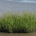
Common cord-grass Spartina anglica and its management in estuarine Natura 2000 sites

Client: Natural England

Spartina anglica in Natura 2000 sitesExegesis were contracted to undertake a review of Spartina anglica in England’s Natura 2000 Sites. This covered its impacts on designated features, effects on accretion and erosion, distribution and extent, and a review of control techniques. A protocol was developed to monitor S. anglica and help identify any negative impact.

... read more
 

Scoping Study and Pilot Survey of Upland Habitats

Client: National Parks and Wildlife Service

Upland habitat mapping in IrelandThis project involved the collation and evaluation of a suite of ecological datasets, the production of an indicative map of upland habitats, an investigation of upland field data collection options, and capturing all survey data to GIS.
 

... read more
 
Find out more