Exegesis developed a novel approach for consistently determining rarity statuses, distributions and mapping Irish invertebrates.
Exegesis analysed the distribution and scale of Deer Vehicle Collisions in Scotland, covering data from 2008 to 2021.
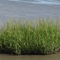
Exegesis undertook a review of common cord-grass in Ireland. This covered its impacts on ecosystems, distribution and extent, and a review of control techniques.
Exegesis were contracted to establish whether aerial imagery from UAVs could be used to investigate the spatial and temporal extent of bait digging at selected sites in Wales.
Exegesis was contracted to establish vegetation monitoring at a saltmarsh coastal realignment site. This required the collection of high resolution aerial imagery, quadrat based vegetation survey, mapping in GIS and production of a detailed report.
We demonstrated through spatial processing and statistical analysis that it may be possible to predict wood pasture and parkland quality. This project generated a model that could be used to target survey effort to those sites with the highest predicted quality.
Exegesis were contracted to undertake a review of Spartina anglica in England’s Natura 2000 Sites. This covered its impacts on designated features, effects on accretion and erosion, distribution and extent, and a review of control techniques. A protocol was developed to monitor S. anglica and help identify any negative impact.
exeGesIS were contracted to investigate the distribution of non-native species on protected sites in England, to help develop a programme of work to tackle Invasive Non-Native Species. Large scale data analysis was used to determine which protected site each species occurred within. We also reviewed data flow within Natural England.
exeGesIS SDM undertook two projects for Cefas to create and update a bespoke Fishing Effort Toolkit that allowed end users to process raw GPS tracks and sighting data and undertake a standardised process to calculate fishing effort for one or more years.
Exegesis undertook an aerial survey of a site and orthorectified and mosaicked the imagery to create a single image. We also generate a digital surface model, which was compared against lidar data to give the change in height. We then determined the volume of additional material within patches identified from the aerial photography.
Telephone: 01874 711145 Email: xginfo@esdm.co.uk